
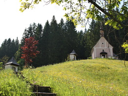
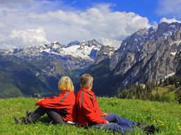
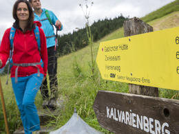
Hiking on Herrenweg in Gosau is a unique nature experience. This panoramic mountain trail takes you from the picturesque Gosau church district up to the Zwieselalm with its rustic alpine huts and imposing Gosaukamm. At the end of the hike you will find the Lake Gosau and Dachstein at your feet!
The 10 kilometer long Herrenweg in Gosau at Dachstein leads up to the Zwieselalm at around 1 500 m above sea level. The hike is, despite the alpine situation, a simple hike, suitable also for families. On forest roads, hiking trails and wood trails, the path winds through the forest landscape above the idyllic Gosau valley.
by car
from Salzburg:
Motorway exit Golling via B162 Abtenau and B166 to Gosau
from Linz:
Motorway exit Regau on Salzkammergut street B145 towards Gmunden and Bad Ischl to Bad Goisern, in Bad Goisern turn right onto B166, at the Gosaumühle junction turn right towards Gosau
from Vienna/Graz:
Motorway exit Liezen on the B320, in Trautenfels turn on Salzkammergut street B145 to Bad Aussee, turn on Koppen street through Obertraun and Hallstatt, at the Gosaumühle junction turn left towards Gosau
from Villach:
Tauern motorway to exit “Eben im Pongau”, via the B166 Pass Gschütt federal road to Gosau
by train
Attnang-Puchheim - Stainach-Irdning lines
Arrival by train in "Steeg / Gosau" then continue with bus 541/542 in the direction Gosausee
By bus
Bus 470 (Abtenau - Gosau) direction Gosau, stop Gosau Abzw. Pass Gschütt
Bus 541/542 (Bad Ischl - Gosausee) direction Gosausee, stops Haltestelle: Gosau Klaushof, Gosau Bärnausiedlung, Gosau Ressenbachweg, Gosau Vordertal B166, Gosau Ramsau B166, Gosau, Gemeindeamt, Abzw. Pass Gschütt, Gosau Wirtsweg, Gosau Leitenweg, Gosau Schüttmannweg, Mittertal b. Gosau Ort, Mittertal, Hornspitzlift, Hintertal b. Gosau Falmbach, Hintertal b. Gosau Mühlradl, Hintertal b. Gosau Ort, Hintertal b. Gosau Madlgasse, Hintertal b. Gosau Schmiedweg, Hintertal b. Gosau Freilichtmuseum,Hintertal b. Gosau Zwieselalmbahn (Panoramajet), Hintertal b. Gosau Gosaukammbahn
Detailed information on the respective train and bus times can be found at https://www.oebb.at/en/ (train) and https://www.postbus.at/en(bus).
According to the notice
E-service station / recharging stationPlease get in touch for more information.
You can also visit us on
Visit us on Facebook Visit us on Instagram Visit us on Pinterest Visit our videochannel on YouTube WikipediaPlease let us know how we can improve the quality of this property or if there is any incorrect information on this page (eg. opening hours, contact, etc.).
Please fill in all fields marked *.


