
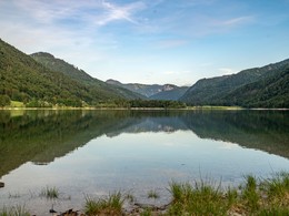
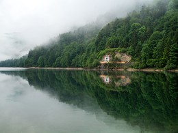
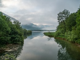

Learn all about animals and plants around the lake Hintersee
The Hintersee enjoys the reputation of being one of the most versatile lakes of the Salzkammergut. The 5 kilometre trail around the Hintersee is ideal for family walks and prams. and bribes you with its open and free lakeshores. Information boards explain all about the flora and fauna as well as the life in the lake.daily accessible
By car:
Arrival via the West motorway A1, junction Thalgau.
Follow the main road (B 158) in direction to Hof bei Salzburg until you reach the traffic circle “Baderluck”. At the first junction turn into the main road (Hinterseestraße) and after a few kilometers you reach your holiday destination Faistenau.
With the Postbus
From Salzburgs bus station, opposite the train station, there is a good bus connection into the
Fuschlsee region and also to Faistenau. You will find details in internet under www.svv-info.at.
With the Train
Information and connections can be found under following addresses www.oebb.at or www.bahn.de
By Air
Salzburg Airport lies very close to Salzburg city. The Bus Nr. 2 brings you from the airport to the main station where you change to continue with the post bus.
no parking fees
Please get in touch for more information.
You can also visit us on
Visit us on FacebookPlease let us know how we can improve the quality of this property or if there is any incorrect information on this page (eg. opening hours, contact, etc.).
Please fill in all fields marked *.


")
")
")
